DX
Atlas - Electronic World
Atlas for Radio Amateurs. You can drag the map of the world with the possibility
of increasing the selected region. DXAtlas shows DXCC territories, prefixes,
Grid Locator squares, CQ and ITU zones. It displays the world in a
rectangular, azimuthal projection and as a globe with a 3-dimensional
topography. Gray Line, showing the cities and islands by their names,
hierarchical database of prefixes, local time for all cities, islands and
regions. Unique ionospheric map, support for the lists of award programs
IOTA and RDA. DXAtlas window: It can work with HamCAP, IonoProbe, Band Master and many other programs.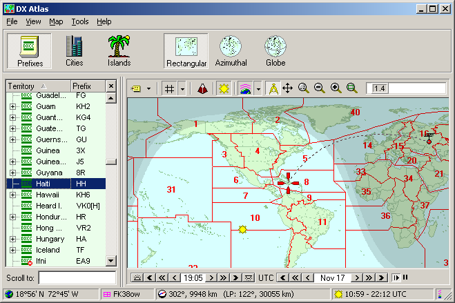
This help-file is written by Serge Rodnikov aka UA4FFF